

O município de Rio Claro, incluindo suas zonas urbana e rural, aparece com diferentes níveis de risco para incêndios, em novo mapa divulgado esta semana pela Defesa Civil Estadual. O mapa classifica áreas do Estado com níveis baixo, alto, de alerta e de emergência.
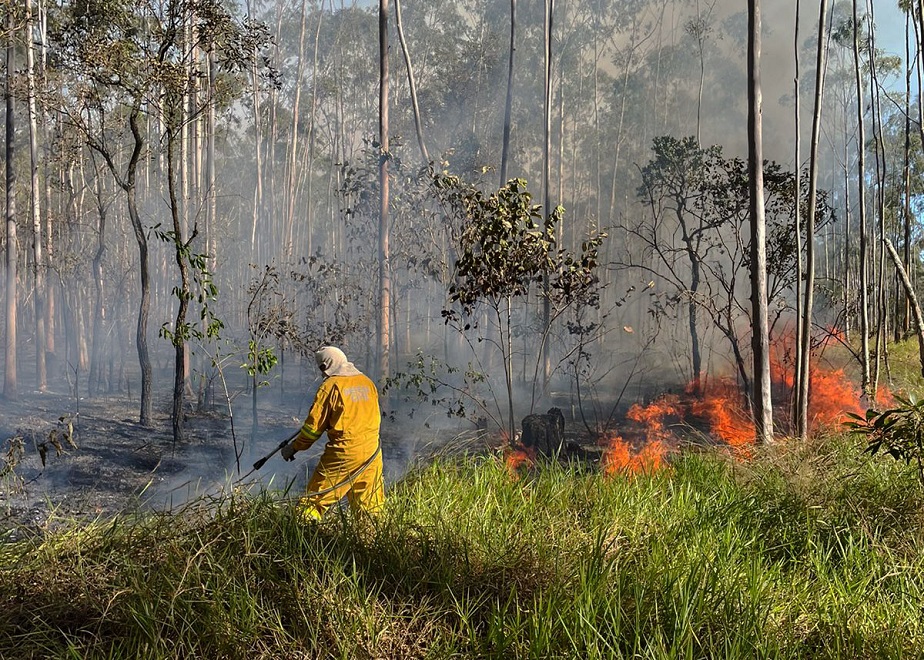
O levantamento do órgão aponta que em junho houve redução de 41% no número de incêndios florestais e foi justamente no dia 18 daquele mês que a ocorrência mais relevante dos tempos recentes foi registrada na cidade, com uma queimada que devastou uma área importante próxima a uma região da Vila Industrial, numa parcela pertencente à Feena (Floresta Estadual Edmundo Navarro de Andrade).
O mapa da Defesa Civil do Estado aponta Rio Claro, que registrou de 1 a 10 de julho mais de 90% da chuva prevista para todo o mês, sem risco de incêndios no mapa que retratava justamente a última quarta-feira.
Já com a volta da estiagem, ontem, dia 11, município aparecia na área demarcada no mapa com níveis de risco alto e de alerta, situação que praticamente se repete na data de hoje, dia 12, melhora um pouco amanhã, dia 13 e volta a se agravar nos dias 14 e 15 de julho, conforme o mapa da Defesa Civil paulista.
De acordo com o órgão, a atual estiagem apresenta mais riscos de incêndios florestais em relação aos anos anteriores, devido às condições climáticas de baixa umidade do ar e tempo seco.
“O estado de São Paulo possui um outono e inverno com climatologia de tempo mais seco, com tendência para que a Umidade Relativa do Ar diminua significativamente, atingindo níveis mais críticos diariamente, ou seja, valores abaixo dos 30% em praticamente todas as áreas monitoradas”, explica Willian Minhoto, Meteorologista da Defesa Civil.
Neste período de estiagem, o Centro de Gerenciamento de Emergências funciona 24 horas por dia monitorando os riscos para queimadas. Uma das ferramentas é o Mapa de Risco de Incêndio, que utiliza algoritmos que cruzam dados como umidade relativa do ar, temperatura, velocidade do vento e previsão de chuva, classificando as regiões com maior probabilidade de queimadas por meio da escala de cores vista no mapa.
Prevenção contra incêndios
Diariamente, o Centro de Gerenciamento de Emergência (CGE) da Defesa Civil estadual encaminha o Mapa de Risco de Incêndio para todas as Coordenadorias Municipais. Aquelas inseridas em uma área com risco mais elevado recebem um indicativo de alerta.
Deste modo, são adotadas medidas de prevenção como vistorias nas áreas mais suscetíveis às queimadas, construção de aceiros e intensificação das campanhas de conscientização junto à população.
Para prevenir incêndios em vegetação, a população deve seguir algumas medidas: não colocar fogo em áreas de vegetação seca, não jogar bitucas de cigarro em beiras de rodovias, não realizar a limpeza da área rural utilizando técnicas com fogo, não queimar lixo e não soltar balão.
Ao avistar fumaça suspeita ou fogo de incêndio em mata, informe imediatamente o Corpo de Bombeiros (193).
Foto: Defesa Civil de Rio Claro